Showing posts with label Indonesian Archeology. Show all posts

Maluku (Moluccas)


Maluku/Moluccas has underwater park is very beautiful, charming tropical beaches and volcanic mountains surrounded by woods. The island is an island famous rempahyang spices and has attracted many traders from India, China, Arab, and Europe to seek cloves and nutmeg. In 1511, the Portuguese built a fort on the island of Ternate their first, and managed to monopolize the clove trade. The arrival of the Dutch in 1599, is a serious threat to that control natural wealth Pourtugis embarrassment. Armed conflict broke out, they take great customs of the people of Maluku. The Dutch finally emerged as the winner, then they monopolize trade with an iron hand. Entire villages were razed to the ground and thousands peduduk dead island, especially on the island of Banda. The British then occupied Maluku during the Napoleonic Wars, but in 1814 returned and it was not until 1863 the cultivation of spices was abolished in the province.

Currently the fish and other marine products are the main source of income of the people of Maluku. There are also nickel, oil, manganese, and various types of wood as a commodity area.

ENTRANCE

The main entrance is through the Moluccas to the provincial capital Ambondengan regular flights from most parts of the archipelago. Air and sea transport linking the islands with 79 ports and 25 airports. There is also access to many remote islands are interesting to visit.

HISTORY

The name comes from the Arabic Maluku estimated that 'Jazirat al-Muluk', which means the land of kings. This is possible because Maluku kingdoms such as Ternate, Tidore, Bacan, and others. Kora-kora, is their famous fleet strong, equipped with war canoes were able to explore the Sulawesi Sea and Alaska when their golden years. The king get their wealth of spices, especially cloves. At that time the price of cloves and spices are very expensive because of its ability to preserve food not like now with the refrigerator.

When the spices are also used as a medicine and Europe this plant can not grow. Shipping spices to Europe must pass through these complicated, this is what causes the price becomes very expensive. Then the Europeans think the price of spices would be cheaper if they come directly to the place of origin. From this a kolonialismepun era began.

Portuguese came the first time in 1510 danmereka trying to monopolize trade in the Moluccas. Next came Spain and both had to contend with opposition kingdom of Ternate and Tidore until not long before they give up.

Dutch then came up with the provision of financial and persenjatan more good.They also experienced in the administration of trade and harder against the people of Maluku. Residents who refuse to cooperate in the Banda islands were slaughtered ruthlessly, and partly employed as slaves.

During the fall of VOC, Britain then ruled here for a year but this is problematic because the British smuggled from Maluku seeds to be planted in Malaysia and Ceylon (Sri Lanka). As a result, no longer the center of Maluku spice for search of spices can be found in other places closer.

CULINARY

Many seafood can be found here. Try the grilled or baked fish while you enjoy a beautiful view of the Moluccas.
Fish rice (rice and fish meal) is also worth a try.
If you are interested in trying to concoct a meal in itself, it can buy fresh ingredients at the nearest supermarket and small shops.

SOCIETY AND CULTURE

Historically Moluccan community is very diverse, consisting of a nation Malay, Indian, Arabic, Chinese, Portuguese, Bugis and Javanese. Ua-ulu community chose not dressed traditionally where men can be identified with a red head cover.
tourist agency

Department of Culture and Tourism Prov. Moluccas
Jl. Jend. Sudirman, Batu Merah, Ambon
Tel. (62-911) 312300
Fax. (62-911) 352471
website: http://www.malukuprov.go.id/

BANTEN


Historically Banten used to be a strong maritime town rival kingdom of Mataram and now this area is a fishing village where you will still get a reflection of his past. The capital of Banten province is Serang. Banten is one of the first famous historic place, is just 10 km from the city of Serang. In this place, you will see a lot of the legacy of empire founded the 16th and 18th centuries.

Banten You will find the traces of the Islamic empire. The most famous being the Great Mosque and the ruins keratonnya. Banten Great Mosque was built the 16th century and still exists to this day that characterizes the early Islamic architecture.

Ujung Kulon National Park is one of the national parks and nature conservation site in Indonesia yan gdapat you kunjingi in Banten. At this location, you can see the beauty of tropical forests and one-horned rhino (Rhino sondaicus) which form the main tourist attraction.

There is also Pulau Umang located in the tourist area of ​​Pandeglang coast, adjacent to the tourist area of ​​Tanjung Lesung. This tourist resort is managed by a private company that provides a variety of recreational and entertainment facilities are attractive. On this island, there is a resort styled with a natural artistic flair, equipped with meeting rooms, cafe, spa, business center, sunset lounge, beach club, swimming pool and so on. In addition, the available water sports and leisure facilities, a jogging track, cross country, tennis courts, karaoke, and others. You can go to this island with relative ease. Because the district management company provides a car rental from Jakarta to the island or can also be reached from Ujung Kulon.

There is also a nature reserve Swamp Lake (Rawadano) located in Serang district within 101 km from Jakarta. This area is an area other than the swamp area there is also a lake. The area is about 2,500 ha are covered by various types of trees. The island became a nesting place for various kinds of animals such as reptiles, such as snakes and crocodiles.

Do not forget also in Banten you can visit Mount Krakatau, located in the waters of the Sunda Strait. Region's beautiful natural attractions easily you kujungi of Anyer-Carita beach about one hour by motor boat. At this location you can camp, hike, fishing, and of course enjoy the beautiful natural scenery and charming sea.

Mount Krakatau is one of the most famous mountains in the world, because of the devastating eruption in 1883. The eruption voice audible to the Australian continent region, even heat clouds blanketed some areas of Europe during the week. A huge explosion of Krakatoa volcano mountain children then formed what is now known as Anak Krakatau, came to the surface in 1928 and has remained active.

ENTRANCE

Soekarno Hatta International Airport is the main access to Banten. You also reach Banten by car or motorcycle through the Jakarta-Serang. There is also a bus in 4 Pakupatan terminals, Terminal, Terminal Porisplawad, Labuan Terminal and Terminal Merak.

HISTORY

Banten in the illustrious history as a port city that is very crowded with people who open and prosperous. 5th century Banten is part of the Kingdom Tarumanagara.
During the reign of Sultan Agung (1651-1683) Banten experienced its golden period. Unfortunately after Banten decline and then the Dutch took over.

Early 17th century AD, Banten is one of the important commercial centers in the path of international commerce in Asia. His territory includes what is now the province of Lampung. When the Dutch arrived in Banten for the first time, the Portuguese have long entered into Banten. Later the British set up lodges in Banten, and then followed by the Netherlands.

In addition, the people of France and Denmark has ever come in Banten. In the competition between European traders, the Dutch emerged as the winner. The Portuguese fled from Banten (1601) after their fleet was destroyed by the Dutch fleet in the waters of Banten. The English are also excluded from Batavia (1619) and Banten (1684).

After the independence of Banten initially was part of West Java province, but separated since 2000 by the decision of the Law No. 23 of 2000. The headquarters is located in the city of Serang. Banten region has many industries are also some sea port developed in anticipation to capture the excess capacity of sea ports in Jakarta, and is intended also to be an alternative to the port of Singapore.

Sunda Strait makes Banten is one lane of traffic due to strategic sea impassable large vessels connecting Australia and New Zealand with the Southeast Asian region. In addition, Banten is the link between Java and Sumatra.

CULINARY

Try milkfish satay offerings, one of the specialties of Banten. These fish without spines which included meat fish into the fish skin that has been mixed with spices and finally burned. Sate milkfish is resistant beberpa day. It was sweet, savory and delicious. Therefore, you do not miss a bite.

SOCIETY AND CULTURE

Banten is Sundanese community religious though sometimes still believes in the old traditions and customs.

Among others who still adhere to the tradition is the Bedouins or those Kanekes (Urang Cibeo) that inhabit the foot of the mountains in the village Kendeng Kanekes, Leuwidamar subdistrict, Lebak-Rangkasbitung, located about 40 km from the town of Rangkasbitung. People Kanekes 'in' do not know the culture board, so that the customs, beliefs, and stories of ancestors is only stored in the speech orally.

Kanekes community trust called Sunda Wiwitanyang rooted in the worship of ancestral spirits (animism) which then further influenced by Buddhism, Hinduism, and Islam. The core belief is absolute customary provisions adopted in everyday life. Essential content 'pikukuh' (compliance) Kanekes is the concept of "without any change", or change as little as possible. For some people, indigenous beliefs held Kanekes reflect the religious beliefs of the Sundanese people in general before the advent of Islam.

Tourist Agency

Regional Government Center Banten (KP3B)
Syech road Nawawi, PALIMA - Serang
Tel. 0254.267060
Fax. 0254.267070
Email: disbudparprovinsibanten@yahoo.co.id
Website: www.bantenculturetourism.com

Traditional Clothes of West Papua


Traditional clothes of men and women in Papua physically you might conclude that these clothes are similar. They wear clothes and body cover the bottom with the same model. They also both wearing the same ornaments, such as a headdress in the form of birds of paradise, bracelets, necklaces, and belts of beads and fringe at the ankle. Forms of dress depicted here is a new creation. Customarily not forget to spears / arrows and shields held the groom give the impression of indigenous Papuans.

Apparel Wedding Bride

Wedding attire worn by the bride is in white dress, red-brown. Papuans did please the white color in the dress, it is a development that goes hand in hand with time.

Although they still love the vibrant colors and patterns typical of Papua, such as beads or bird of paradise plumes. The combination of colors used symbolized by the color hue birds of paradise feathers.

Indigenous Elders and Religious Clothing

Imposed by traditional elders and religion are different. Indigenous elders typically use traditional Papuan traditional clothing, bird of paradise feathers and ornaments boar tusks. While Elders Religion wore a yellow robe and matching flannel uniform.

Wedding Apparel Society

Local people became groomsman generally wear plain or dress their best. Or failing that, in general, local wear gloves woven with superiors regular clothes or white clothes - which signifies purity.

Unlike the penis sheath. The following explanation of the clothes or the clothes of the indigenous Papuan:

Koteka is a unique skill, which is solely owned by the tribal people in Papua, where the sheath is a custom clothing used at the time unfamiliar pants used to cover (sorry) male genitalia.

Origin

Sheath made of leather Labu Air. how made by removing the contents and pumpkin seeds that are old, and the skin in the sun. Koteka words literally, means Apparel, comes from one of the tribes in Paniai. partly Jayawijaya mountain tribe called it hilom or Horim

Many tribes which can be identified by the way they use the sheath, for sheath short use at work and long with attribute decoration, used when carrying out ceremonies, but every tribe has a different shape Koteka, for example Tribe Yali, has the shape of pumpkins long, whereas Tiom people usually wear two pumpkins.

Function and Philosophy Traditional Clothes Papua (Koteka)

In modern times, Koteka increasingly marginalized, will function deserves to remain in the preserve by the way - how to transfer my Koteka functioned without leaving values ​​- values ​​contained therein. Koteka can be used as a medium of painting and souvenirs for tourists, besides, to preserve the same also appreciate art and skills of local residents.

Koteka is a cultural asset of the nation, even in the modern era later Koteka already has other functions, but it remains a part of the culture should not be forgotten, by continuing to preserve their culture, the same has also been maintaining cultural assets that have value - the value of ancestral therein and not lost amid the changing times.

Architecture Fort Marlborough


Citadel is a military locations or buildings erected specifically, reinforced and covered used to protect an installation, area, troops from enemy attack or for control of an area.

Some Marlborough fort building components include:

Revaline is angled three defense building, generally located at the top of the trench in front curtine connected by bridge to the fort buildings. At Marlborough fort, part revaline initially serves as a defense. However, during later functioned as well as social facilities. This is evidenced by the three pieces of the tomb is the tomb of Thomas Parr, Charles Murray and Robert Hamilton. In addition to the three tombs tesebut there are also four plaque is in English pasted on the walls of the entrance gate that reads: George Thomas Shaw, who died on 25 April 1704, Richard Watts, who died December 17, 1705 at the age of 44 years, Henry Stirling who died in April 1744 at the age of 25 years and Capt. James Coney, who died in February 1737 at the age of 36 years.

Outside the building there is a moat around the castle with a moat depth of 1-3 meters and a width of 7 meters. The roving ditch used as a first defense against enemy attacks and disposal of water flow from the fortress. To connect with curtine part revaline built a bridge as a link. Curtine a major defensive wall revaline a fortress located between two bastions.

Bastion is the part that juts out located at each corner of the fort. Keletakannya allows one to shoot without having to show himself and can shoot in any direction freely. Was first developed by the Italians in the late fifteenth century and early sixteenth century. At Fort Marlborough there are four bastions that bastion northern, eastern bastion, bastion southern and western bastion. Bastion West had a room that functioned as a prison as much as two-room and basement.

Building between the eastern and southern bastions, there are 5 rooms with connecting doors that overall as much as 13 pieces shaped door bars. Building the southern bastion and bastion west is divided into two sections separated by a hallway main gate. Buildings west side consists of three rooms separated by a partition wall. Building east, there are seven rooms were constrained by the bulkhead wall. Building between western and northern bastion currently only trace of the former floor of the building, the shape of the building can not be unknown anymore. Building between the north and eastern bastion is divided into two buildings separated by a hallway behind the gate. On the west side door of the building consists of three rooms. Building the east side of the door consists of 4 rooms.


At Fort Marlborough there are four turrets at the top of the bastion. Each one cannon on bastion to the north and south, two cannons in eastern bastion, with the kind of caliber cannon 10 cm.

Fort Marlborough function as the center of defense at the time of the UK to be reduced, and functioned as a trading base. This was shown in 1803 the EIC Board decided to make Fort Marlborough as a center for spice stockpiling of English throughout the East Indies.

Piso Gaja Dompak, Batak People Inheritance


Piso Gaja Dompak are traditional weapons originating from North Sumatra. The name piso gaja dompak taken from the word which means the blade piso functioned for cutting or piercing, and the shape of the pointed and sharp. Called gaja dompak, look like elephant carving as it means on the gun handle.

Piso Gaja Dompak, Batak typical weapon is the inheritance of the Kingdom of Batak. The existence of these weapons cannot be separated from its role in the development of the Kingdom of Batak. This weapon is used only among Kings only. Considering this weapon is also a Royal heirloom, this weapon is not created to kill or injure others. As heirlooms, this weapon is considered to have supernatural powers, who will provide spiritual strength to its owner. This weapon is also the objects dikultuskan and ownership of this weapon is limited to the descendants of the Kings or in other words it was not owned by those outside the Kingdom.

There has been no historical records which mention when exactly Piso Gaja Dompak become an heirloom for the Kingdom of Batak. However, the search results from author Piso King Dompak is closely related to the leadership of King Sisingamaraja i. it is based on the trust of the community against the myth derived from oral traditions recorded in the script.

Tells about a man named Bona Ni Onan, youngest son of King Sinambela. Told during a trip home from afar, Bona Ni Onan found his wife Boru Borbor old is pregnant. He doubted that his wife's womb. Until one night he dreamed of, when the spirit. It said that child in the womb of his wife was the avatar Spirit Bathala and later the child will be King termed Sisingamaraja.

Bona Ni Onan then ensure the dream the truth to his wife. His wife else told me that while he was bathing in sulu – sulu spear (jungle), he heard a roar and Saw the light took possession of his body. After learning that she is pregnant. He also believed that at that time he met the spirit of Bathala.

The period of her pregnancy reached 19 months and the birth of his son ever accompanied a storm of Typhoon and earthquake. By his son's hence he named Manghuntal meaning earthquake rumbling. Go mature Manghuntal started the magical properties showed that reinforces predictions that he is the future King.

In adolescence, Manghuntal went to see the King, raja Mahasakti Uti to gain recognition. At the time he was about to meet the King of Uti, he waited while eating food serve by the wife of the King. When it accidentally he found King Uti hiding in the roof with a snout like a pig.

King Uti ever say hello to manghuntal, he also conveys his return met the King and asked for a white elephant. King Uti ever willing to give to the terms Manghuntal should bring sign-sign from around the region of Toba, Manghuntal ever did. After that Manghuntal back to meet the King of Uti by bringing the terms of Uti. King Uti then gave a white elephant as well as two Royal heirloom that is Dompak and an Elephant Piso spear frontage Hujur Siringis.

Allegedly, Piso Gaja Dompak cannot be released from pembungkusnya except by people who have supernatural powers and Manghuntal can open it. Post it Manghuntal really be King Sisingamaraja I. until recently Batak still trust this myth.

In addition to the inheritance that is so respected and dikultuskan, Piso Gaja Dompak this contains a symbol-a symbol of a meaningful philosophical. Tapered shape of this weapon, in the Batak language called Rantos meaningful intellectual acuity and intelligence thinking. A sharp look at the problems and opportunities, as well as in drawing conclusions and act.

Batak leaders implied that must have the sharpness of thought and intelligence in a saw an issue. Always conduct the deliberations in taking decisions and to take an action as a form of ' wit and acuity to think and view issue '.

Berpenampang elephant carvings allegedly taken from myths provide piso gaja dompak and a white elephant in the Manghuntal or Sisingamaraja i. Piso Gaja Dompak is greatness had taken the leaders of batak, batak leaders have the intellectual intelligence to do justice to the people and responsible to the Lord.

According to the results of the interviews with the grandson of Raja Napatar Sisingamaraja XII, one of the sources mention that Gaja Dompak was in Piso's National Museum. While other sources mention that the weapon or heirloom Piso Gaja Dompak located in one of the museums in the Netherlands along with stamps of the Kingdom of Sisingamaraja.


Kebudayaaan Indonesia

Kampung Bena, where ancient megalithic traditions continue to thrive

Overview
When travelling to the island of Flores, donot omit to put Kampung Bena, - or the traditional village of Bena -  on your must-visit itinerary. Located  some 18 km from the town of Bajawa, here time seems to have passed over Kampung Bena, where until today villagers still faithfully follow megalithic traditions, where sincere friendliness to strangers comes from the heart, where all around  the village you will see vestiges of an age long gone when large stone monuments to ancestors were an inseparable part of daily life. The megalithic village of Bena is one of Indonesia’s rich living cultural heritage that can still be enjoyed to this very day, but should also be carefully preserved.  

Safely protected in the shadows of looming Mt. Inerie, the Village of Bena in the district of Bajawa, is one of a number of traditional villages on the island of Flores that still embrace the awe-inspiring megalithic culture until today.   The town of Bajawa itself is completely surrounded by mountains and a tourist attraction in its own right because of its cool mountain air.

Life in the village of Bena seems not to have changed since the megalithic age some 1,200 years ago. Here are 9 clans living in 45 houses. These are the Dizi, the Dizi Azi, the Wahtu, the Deru Lalulewa, the Deru Solamae, the Ngada, the Khopa and the Ago. Each clan lives on a different level of the terraced village, with the Bena clan in its center. This is because the Bena are deemed the oldest clan and founder of the village, for which reason the village is named Kampung Bena.

In general, the inhabitants of Bena live from agriculture tending to the many green gardens planted on the slopes of deep valleys surrounding the village. They communicate with each other in the Nga’dha language. Most villagers are Catholic. Nevertheless, they still follow the ancient believe in ancestor worship, its rituals and traditions. 

The Bena follow kinship following the mother’s line, where a man who marries outside his clan will belong to his wife’s clan. While Bena women must be adept in weaving the traditional Bena cloth that have typically elephant and horse motifs unique to this village.

Today Kampung Bena counts 326 inhabitants in 120 families. However, those related to the tradition (or adat) and to the village are thousands of village descendents now living outside the core village.

Bena villagers believe that the god Zeta resides on the peak of Mt. Inerie. This mountain, which reaches 2,245 meters above sea level is overgrown with thick forests on its west side only, while its south side is planted with various orchards or gardens. To the Bena people, Mt. Inerie is the right of the mother (hak mama) , while Mt. Surulaki is the right of the father ( hak bapa).    

Today, Mt. Inerie has become an attractive destination for mountain climbers and adventure seekers especially during the dry season that lasts from June through August. From its peak one has a spectacular 360 degree panorama on the surrounding landscape, including on the town of Bajawa to its north west. To the south lies the blue Sawu sea that breaks its waves right on the shores at the foot of this mountain. Mt. Inerie exploded in 1882 and 1970 leaving behind rich fertile soil on this already fantastically beautiful scenery. Notice the unusually large bamboo shrubs that grow around this mountain!

Get There
Ngada Regency is situated between Nageko Regency and East Manggarai Regency. Ngada stretches from Riung district with all its islands and underwater splendors to the  north,  to Aimere to the south.

As the capital city  of Ngada Regency, Bajawa can be reached from Ende, Nagekeo, and Manggarai. If you want to use public transportation, there is an inter-city Bus Station just outside of Bajawa which connects the town with other parts of the province.

The road connecting Soa and Bajawa is relatively smooth and is in good condition. You will also be indulged with spectacular natural sceneries along the way.

Bena Village is situated some 18km from the heart of Bajawa. For your convenience, you can rent car or motorcycle so you can explore more of what Bena and Bajawa have got to offer.  

To Do
When entering this village you will see a large number of large stones that are laid out in special formations. The Bena community believes that mountains, stones and animals must be respected as part of the environment and even of existence itself.

You will also notice the neatly laid out houses with their sharp thatched roofs standing on different levels of this terraced village. Kampung Bena stretches lengthwise from north to south where there is only one entrance to its north. This is because to its south, which forms the the highest point of the village, the land plunges immediately into a deep valey.

Kampung Bena measures 375 meters long and 80 meters wide. There are at least 45 traditional houses interpersed with large megalithic stones. Notice the 9 levels of terraces where each clan inhabits a specified level.

The central house for men is called sakalobo, that is recognizable by the male statue holding a machete and a lance placed above the house. Whereas the house for women is called sakapu’u.
You will also see many houses decorated with buffalo horns, and jaws and tusks of wild boars,denoting the social status of its owner. The jaws and  tusks of boars are offerings given by each clan through a traditional ceremony. 

Ngadhu structure stands in front of each cluster of houses, which symbolizes the male ancestor. A ngadhu is a miniature house shaded by an umbrella that stands on a carved pillar. Its roots must have two branches which has been planted at a ceremony involving the blood of a boar or a chicken. The ngadhu must stand on a strong pole made of special hard wood that must be strong enough to bear the weight of the heads of animals that are to be offered at ceremonies.

Just as a Ngadhu stands in front of each traditional house, the bagha is the symbol of the female ancestor. The bhaga is a small traditional house that is prepared to receive bridegrooms of the girls from the village  who are given in marriage to an outsider. Each bhaga  has carvings (bhaga) while on its roof are weapons meant to protect the house from evil spirits. The bhaga also serves as life’s motivator for children and as reminder that wherever they may roam they must always keep in mind that this is their village of origin. Because there are 9 clans in Bena,  the village has nine pairs of ngadhu and bagha.

Reaching the highest and most southern point of Kampung Bena you will be amazed by the scenic panorama that meets you. From this vantage point you can see deep valleys stretching out to the mountains and to its right the Sawu Sea.  Be sure to take a photograph of this most extraordinary view.

A special feature of daily life here is chewing betel leaves with limestone which tradition has been handed down from generation to generation. Chewing betel leaves is believed to be invigorating and gives an added bonus as it leaves red coloring to the teeth. This snack may be taken any time of the day, in the morning, noon or even at night.
This blend of betel leaves, areca nut, lime, gambier, and some tobacco leaves produce a red color residue and fibre of the areca nut. The whole concoction does not taste sweet but trying this may be one of the sweet memories of your visit to Bena.   

When you are in the village of Bena you will most likely notice candlenuts (Aleuritis molucana) spread and dried in the sun.  Villagers here roast the nuts without oil or boil these to take away the toxic elements. While natural drying in the sun is of course a better way. Candlenut is used to extract oil that can also be used to mix dyes.

To Stay
There are a number of simple hotels and inns available in Bajawa. Although you may not find any star-rated hotel facilities, the sheer refreshing climate and the pure hospitality of the people are truly a special feature of the town.
Here are among some of the accommodations available in Bajawa:

Hotel Edelweis
Built in 1988, the hotel features a family house ambience and charges from IDR175,000 to IDR250,000 per night.
Address: Jalan Ahmad Yani No. 76
Telephone: +62 384 21345

Hotel Jhony
The hotel has been around for over 35 years with rates ranging from IDR100,000 to IDR200,000.
Address: Jalan Gajahmada
Telephone: +62 384 21079

Hotel Nusantara
This simple hotel has 18 rooms and is dedicated for non smoker only.
Address: Jalan El Tari No.10
Telephone: +62 813392 38860

Hotel Korina
A relatively simple hotel but features excellent service. The rates varies between IDR100,000 to IDR200,000 per night.
Address: Jalan Ahmad Yani
Telephone:+62 384 21162

Happy Happy
An old residential house converted to a hotel featuring classic architecture. You will definitely feel a different comforting ambience with all the classical features of the hotel.
Address: Jalan Ahmad Yani

Villa Silverin
A little bit far from the heart of Bajawa, this means less noise and more peacefulness. The rates range from IDR200,000 to IDR350,000.
Telephone: +62 384 222 3865

To Eat
Once you set foot in Bajawa, you definitely must try some of the local cuisine which features its own distinct taste. Some of the restaurants here serve distinct Bajawan dishes including the famous Sambel Bajawa or Bajawa Hot Sauce which is made from Flores Chili Pepper, which is small in size but notoriously hot, hot, hot.
Here are some of the restaurants in Bajawa:

Restaurant Camelia
The Restaurant combines amazing scenery and ambience as well as live music entertainment to accompany the delicious food and refreshing drinks.
Address: Jalan Ahmad Yani no.74
Telephone: +62 384 21458

Dito’s
This cozy place features dashing interior design and decorations and serves a wide range of menus from European, Indonesian, and Chinese.
Address: Jalan Ahmad Yani
Telephone: +62 813 3919 8600

Kasih Bahagia Restaurant
A popular Chinese restaurant famous for its spring rolls, Chicken Soup, and pork noodle.
Address: Jalan Basuki Rahmat

Lucas Restaurant
The restaurant features traditional ambience which is both unique and classy. Its owner, Lucas will entertain you with the history of Bajawa and also the culture of Ngada.
Address: Jalan Ahmad Yani
Telephone: +62 813 53090 7073

Tips
There is an unwritten rule that Bena inhabitants shold not disturb tourists. But tourists are encouraged to greet them. Then witness their broad welcoming smiles shining from their sincere faces.

An annual feast is held in this village around December or early January called Reba. In the past, these feasts lasts for over one week involving the slaughter of cattle, boars and chickens.  Nowadays however, these festivities will last no longer than three days to limit the animals being slaughtered.

Make sure that you donot leave garbage behind, but do carry home some wonderful, stories and photographs of this village and villagers who until today still retain their rare ancient living culture. 

Do admire their extraodinary woven creations that are hung outside their house. You can buy these materials and you are also allowed to bargain for the best price. 

Indonesia Travel

Lampung Museum : Traces of the Past


Over View
Lampung Museum is the only museum in Lampung Province, the southernmost province on the island of Sumatra, as well as a significant monument amongst the Lampung community. It is strategically located just 15 minutes from the heart of Lampung’s capital city, Bandar Lampung.

With the use of Lampung’s distinct architectural style, the museum is a path to retracing the past through an extensive display of prehistoric artifacts, cultural relics as well as the flora and fauna which are typically found in Lampung. Antique ceramics from other countries such as China and Siam are also among the Lampung Museum’s collection. Based on the inventory from 2011, the museum holds a collection of over 4,700 items. These are divided into 10 groups which are the items related to geography, biology, ethnography, history, numismatics, phylogy, ceramics, fine arts and technology.

The largest part of the collection is dedicated to ethnography, which is the study of culture. So far, there are over 2,000 objects in this category which includes objects that were once used in everyday life and various items characteristic of both the past and present Lampung culture.

The Lampung Museum began its construction in 1975, holding its groundbreaking three years later in 1978. Its grand opening was held many years later on 24 September 1988, where it was inaugurated by the Minister of Education and Culture of the time, Prof Dr. FuadHasan. The inauguration coincided with the commemoration of International Literacy Day which was centered in PKOR Way Halim.

Lampung Museum
Jl .ZainalArifin No.PagarAlam .64 ,
Meneng building , Bandar Lampung
Tel . : 62 - 721-783688
Fax : 62 - 721-701164

To Do
Lampung Museum is a cultural attraction and functions as a destination for education, history, research and recreation.

From your first step onto the museum grounds, a row of cannons line the building’s courtyard, keeping guard over its compounds. These antique cannons are survivors from colonial times and are one of the prime icons of the museum. Replicas of traditional stilted houses also rise from the courtyard, built in such a fashion as a means of protecting the homeowner from wild animals.

Also in the museum’s front square are large iron balls which are synonymous with the historic Lampung transmigration project of 1953-1956, that resettled thousands of people from crowded Java to then uncultivated lands on Sumatra. These huge metal spheres were essential items during the resettlement at East Lampung, North Raman, Purbolinggo, Seputih Banyak and Seputih Raman as they were tools to clear unwanted rubble and shrubbery and flatten the land that would soon become the location for the new communities.

The cultural objects displayed in the museum represent Lampung’s two dominant indigenous ethnic groups; the SaiBathin (Peminggir) and Pepadun. Each of these groups holds their own unique traditions, rituals and customs, as well as utensils used in such customs. The display shows all tools used within the rituals surrounding a person’s life in the Lampung community. It begins with the items used in birth celebrations, on to growing of the first teeth, the transition into adulthood, marriage and finally ceremonies regarding death.

Another hall exhibits elephants and tigers and other fauna native to Sumatra. Nearby, a diorama depicts a miniature scene of the spectacularly devastating eruption of Mount Krakatoa in 1883. Along another hallway lies a display of items taken from various archaeological sites dating back to life in the Neolithic era such as statues and menhirs.

The museum’s collection also includes important historic objects from the ancient kingdom of Sriwijaya. Remains of this kingdom include ancient manuscripts, statues, armor of the royal guards, custom clothing, ceramics, jewelry and the daily currency of that day.

Also stored in the museum are weapons and other significant objects which were used by the Lampung Hero, RadinInten and his descendants.

In summary, the museum contains a wide variety of things to see ranging from relics of prehistoric times, to the Hindu – Buddhist era, to the arrival of Islam, colonialism, and finally, post-independence. In addition to this collection, the museum is also a center for the arts, sometimes hosting events and shows to exhibit the tradition music and dances of Lampung.

Get There
The closest Airport is the Raden Inten II Airport in the city of Bandar Lampung. This is a domestic only airport, serving Jakarta, Bandung and Batam.

The Lampung Museum is located approximately 5 kilometers north of Tandjungkarang, the central area of Bandar Lampung. It is easily accessible by rental car, public transport or motorcycle.

Indonesia Travel

Liang Bua, Home of Indonesia's "hobbits"


Liang Bua is a cave in a limestone hill in Manggarai District, Flores. The local community is familiar with this cave because of its huge size (50 meters long, 40 meters wide, and 25 meters tall). Due to its size, it was once used as a religious worship place and school.

Liang Bua is famous the world over following the finding of an ancient skull. The skull was that of a short human called Homo floresiensis, found at a depth of 6 meters.  Its brain measured only 380 cc (compared to a minimum 1200 cc for a normal modern human brain). Archaeologists are of the opinion that this skull originated from an era back in time some 18,000 years ago.

In addition, in a depth of 10.7 meters, ancient animal bones were also found including those of stegodon (an ancient elephant), komodo, turtles, and lizards.


Get Arround

 Liang Bua and its surrounding areas are only accessible by foot.

To Do
 Despite its famous archaeological findings, no replica or information about these findings is located in Liang Bua.  Visitors can only see the massive cave with stalagmite stones, imaginating that ancient elephants, komodo and short humans (Homo floresiensis) once lived here thousands of years ago. Near Liang Bua, there are other caves such as Gua Galang (with bathing stones) and Gua Tanah.  You can walk to these caves.

Get There
 Liang Bua is located 14 kilometers from Ruteng, the capital city of Manggarai district. Bemo (rural public transportation) and trucks carrying passengers from Ruteng usually pass this site but their schedule is tentative.  The best way to visit this cave is by taking a rented car or a motor taxi.  To reach Ruteng, you can take land transportation from Labuan Bajo, Ende or Maumere.  Everyday there is a flight from Kupang to Maumere and Ende. There is also a daily flight from Denpasar to Labuan Bajo, and a twice a week flight from Kupang to Ruteng.

To Stay
No hotel is available in Liang Bua.  The nearest hotel or motel is in Ruteng pending availability.  Rima Hotel, Losmen Agung, Hotel Sindha and Hotel Dahlia are good choices to stay in Ruteng.

Tips
Please bring along your own food and drinks.  Be careful when taking a private car or a motor taxi because the road to Liang Bua from Ruteng is very narrow and only accommodates one car in width.  Its driving conditions are also dangerous due to many turns and hills.

To Eat
No restaurant or food stalls are available here.  The nearest restaurant is in Ruteng.  Restoran Merlin, at Bhayangkara Street (0385-22475), serves various types of Chinese and Indonesian foods.  In addition, Agape Cafe, which is also located at Bhayangkara Street, is a new cafe serving espresso, beer, and Western, Chinese and Indonesian foods.

To Buy
No souvenir or handicraft shops are available near Liang Bua.

Mystery Founder Ratu Boko


SITE Boko itself is still a mystery about the historical. No one knows who archaeologist who founded the site, as well as who the kings that reigned in Kraton Ratu Boko.

"If the history has not been solved, it is still a mystery," said Didik Tri Ardianto, Boko TWC Operational Staff.

However, there is little enlightenment about Kraton Ratu Boko. Ratu Boko is an archaeological site in the form of relics of the kingdom of Mataram from the 8th century, the forerunner of the founder of Borobudur and Prambanan.

Historically, Kraton Ratu Boko was used during the Sailendra dynasty before the King Samaratungga (founder of Borobudur) and Rakai Pikatan (founder of Prambanan Temple).

Inscriptions found at the site was issued by the Rakai Panangkaran in 746-784 AD . Ratu Boko called Abhayagiri Wiraha. Abhaya means "no danger", giri means "hill", and the monastery means "dormitory or place". Thus, the Abhayagiri Vihara means" dormitory or monastery for Buddhist monks located on a hill filled with peace (no danger )".

The next period, between the years 856-863 AD, Abhayagiri Vihara was renamed the Palace and fortifications Walaing by King vassal (subordinate) named Rakai Walaing Kumbayoni Pu. Siwagrha inscription mentions this place as a fortress consisting of a pile of hundreds of stone by Balaputra.

From the 10th century until the 16th century there was no news related to Walaing palace. The story continues on 90 years later. In 1790, Van Boeckholtz find any archeological ruins site Kraton Ratu Boko. One hundred years later, FDK Bosch conduct research and report the results of his research entitled Van Ratoe Kraton Boko.

Since then, the site was known as Kraton Ratu Boko. Kraton Ratu Boko name itself comes from the word meaning palace of the royal palace, the Queen means king , Boko means stork .

"Who is the King Stork ? Name a ruler or a bird, sleepy Nobody knows," he said .

Know More Far Jatiluwih as World Heritage


Jatiluwih name, an area of ​​rice fields in Tabanan, Bali, getting stuck after crowned as world cultural heritage site by UNESCO. Traditional subak irrigation system that does need to be preserved that has been handed down from generation to generation and has attracted many tourists to see the beauty of the panorama.

Not only that, the housing surrounding villagers still retain even barns beautiful plow rice, red rice renowned quality. Jatiluwih in Balinese language means beautiful teak. The location of this stunning rice fields lay in Tabanan, about 40 kilometers from Denpasar, or about 2 hours by car.

One of the interesting places that can be visited is Hamlet Gunungsari located at an altitude of 640 meters above sea level with a cool climate in contrast to the atmosphere of a hot beach. Irrigation water in the rice fields so clear and cool so often immerse visitors in the freshness of her curiosity to the water flow on the stretch of paddy panorama Jatiluwih.

However, unfortunately, this picture is not always beneficial for its citizens promising change. Many problems that arise as a function of conversion of land that will not be in line with its current status. In addition, many people who switched professions to become a good employee in the government or in private. Crops and commodities of Jatiluwih for companies engaged in the tourism sector in Bali becomes crucial.

Then who will continue the legacy Jatiluwih as world cultural heritage sites that require management and irrigated rice fields subaknya ? Nowadays Bali has become a barometer of national tourism and also part of the corridor 5 Master Plan for the Acceleration and Expansion of Indonesian Economic Development (MP3EI) which includes Bali, NTB, and NTT. Therefore, it is definitely the program will bring rapid development in various fields.

The accelerated development of wind does not always materialize as an opportunity, because for the people or for the region Jatiluwih Jatiluwih as world cultural heritage could be a threat. This interdependence must be kept in balance, such as the balance of the principle of Tri Hita Karana.

This area needs to be maintained into the area that is not too commercial so spontaneous and sporadic development violate the laws of spatial and tourism can be avoided. Development issues in South Bali can be avoided early in Jatiluwih , generally in the district. Tabanan, with the supervision of law enforcement . Construction of villas and hotel is not something forbidden except when violating the land use designation of statutory pre-defined layout. If that happens as people complained Jatiluwih Gunungsari Hamlet, Tabanan then emphasized that there needs to be a review of a permit that allows construction. In addition to the villas and hotels, Village Tourism is an alternative that should be supported where its presence will further involve local residents.

Tracing Traces History of establishment of Kraton Surakarta Sultanate & Keraton Jogjakarta


Who would have thought when the internal Chaotic Palace in Surakarta, Central Java could not be separated from the history of the palace Kasunanan which is a series of historical Kingdom of Mataram.

Since the establishment of the kingdom of Mataram before finally moved to Sultan Kartosuro, before ending with a standing Keraton Surakarta, the conflict always enliven the Mataram dynasty.

Even until the end of the Mataram dynasty descendants split into two regions of Solo and Jogjakarta always conflict with it. Including, when Sultan Kasunanan territory again divided with the establishment Mangkunegaran , conflicts are always followed.

Son of former caretaker Kartosuro palace, Suryo early to tell where the palace Kartosuro founded in 1680 by the Amangkurat Sunan II, son of Sunan Amangkurat I.

"The establishment of the Royal Palace Kartosuro caused the first was destroyed and occupied by the enemy who is famous for Trunojoyo uprising," said Suryo, at the site of the former palace Kartosuro, District Kartosuro, Sukoharjo, recently.

Plered palace (Ancient Mataram), said Suryo, built by Sunan Amangkurat I Bantul region. Sunan Amangkurat I want a palace area near the fountain that flows so named Plered. But the age of the Kingdom Plered only one period because Trunojoyo uprising.

In Trunojoyo uprising, Sunan Amangkurat I was able to deal with alone. Until finally Sunan Amangkurat I asked for help on the part of the Company in Batavia to quell the rebellion Trunojoyo very devastating . When Sunan Amangkurat I went to ask for help that the Dutch Company, the kingdom fell into the hands Trunojoyo Plered .

" While on the way to meet Governor General of VOC , Amangkurat I sick and died in the area Tegalarum . Prior died Amangkurat I left word with his son Amangkurat II succeeded his father as king and immediately quell the rebellion Trunojoyo , " he said .

Finally, with the help of the Company, Amangkurat Trunojoyo II successfully put down the revolt in 1680. In return, the Dutch asked to submit a return for several ports in Java. Although it is very detrimental to the Mataram, but because after the death of Sultan Agung of Mataram very close to the Company, then the request is fulfilled .

According Suryo, after the successful uprising in Quench Trunojoyo, Sunan Amangkur II refused to return to the Palace Plered. The reason, the palace had been occupied by the enemy Plered is Trunojoyo. Because according to Javanese belief, Kraton that has occupied the enemy is no longer sacred. So he's authority is gone. So abstinence for Amangkurat II occupy the enemy kingdom that once occupied.

Finally on the way home after uprising eradicate Trunojoyo , Amangkurat II stopped by to see the ruler of VOC in Semarang controlled territory Jacoob Cooper . Actually , Semarang is one of the Mataram dynasty controlled territory . But in 1678 in Semarang has been mortgaged to the Company .

Netherlands welcomes the arrival Amangkurat II with grand meeting is a celebration of success and quell the rebellion Trunojoyo two consultation meetings were essentially Sunan Amangkurat II refused to return to the Palace Pleret and wanted a new palace .

"During the meeting, there are actually three locations offered to set up a new palace . Third place diawarkan royal counselor named Nerang Kusuma, the first Loh Gender (Semarang), Tingkir (Salatiga), and pedestal Wanakarta," he said .

Finally in select Wanakarta with consideration that their ancestors never dreamed that Prince yell that his grandson would become the king of the south . He took the region is still there due to the proximity to the ancestral history of Sunan Amangkurat II on the territory Pleret and Display. Selin was fertile and the region close to the springs and protected from Mount Merapi .

Sunan Amangkurat II wanted a new palace to palace Pleret exact same . Keraton at Wanakerta officially began to be occupied in 1680 by Sunan Amangkurat II and named Kraton Kartasura Sultanate. Kartosura forest named Wanakarto taken Karto and suro suro taken from the name of the month (Muharram) which is a very good month.

Century Buddhist temple-10 Found in Sleman

Four Buddhist temples around the 10th century found in Palgading, Sinduharjo, Ngaglik, Sleman, Yogyakarta. This is the result of findings from the excavations conducted in 2006. The structure of the three temples have been found complete, and one other temple is not complete.

Building area of the temple which has been found is a temple on the south side area of ​​13.23 x 17 meters, the temple in the middle of an area of ​​8.6 x 6.35 meters, and the temple on the north side area of ​​8.85 x 8.85 meters. To the north of the temple, while it is still in the research.

Chairman of the Preservation Hall Excavation and Archaeological Heritage (BP3) DIY, Revelation describes Astuti, excavation of temple has actually been done since 2006. But was stopped in 2010, and only continued again in July 2011.

Early excavations carried out since there are reports of a citizen who found the statue is a symbol Buddhisatwa Awalokiteshwara in the worship of Buddha.

The belief that the temple at the Buddhist temple Palgading is finally strengthened after the discovery of one of the stupa at the temple. Not only that, in the excavation of 2011 is also found punden terraces as well as fragments of pottery that looks are no longer intact.

"Until the end of September, we will continue to conduct excavations. There's more possibility of new discoveries," he added.

Three Pillar Mosque to be the symbol of religious harmony

Jami'ul Mosque Community, in the village of Karang Pangsor, District Winner, Lombok Timur, built by the three religious groups: Muslims, Hindus, and Buddhists.


"This mosque is the mosque's iconic antarwarga communion, particularly in the sub district of religious antarpemeluk winner. The mosque will not be able to stand without support from elements of the religious community," said the manager of the mosque. Jamaah own Jami'ul means "all the pilgrims."


Icon of religion of the people of communion not only appear later Lombok Jami'ul Jamaah. Common, other mosque building directly opposite the Temple. For example, in the Village Sesaot, District Narmada, West Lombok. Sesaot village consists of five orchard - three orchards populated Muslim and Hindu population of the two orchards.


Nashrudin Mamik Muhdi, Nurul Huda Mosque manager, explained one of the mosques built by Muslims and Hindus is Nurul Huda Mosque which is a large mosque Sesaot Village. "This mosque is the result of the community in the village of innate energy Sesaot. Many Hindus who participate in the development of this mosque. They donated wood, sand, and whatever they have for the development of this mosque, "show the public figure Sesaot Village.


Nurul Huda Mosque is dealt with in the neighborhood Pura Banjar (Hindu settlements) in the Village Sesaot. Despite, there has never been tumult among them. The young Muslims and Hindus mixed, both in sporting activities and everyday interactions. Mamik adding the religious tenets of people could happen because there is high awareness of the community of peaceful coexistence.

To trace the ancient migration trail

Sumatra Island is geographically located in a very strategic position for fauna and human migration paths in the Pleistocene era. However, the island's early human traces that survive in the ice age is still a puzzle.

From Padang Bindu, District Ogan Komering Ulu, South Sumatra Province, the last village that can be reached by vehicle, a group of scientists from the Centre for Research and Development National Archaeological walk karst hills.

They must go through a suspension bridge crossing the River Ogan, through dense forest and climb the steep hill to get to Goa Tiger, archaeological sites excavated since 2010. In the cave, the research team of 12 people trying to collect traces of ancient settlements from the time of 60000-10000 years ago, to the older, the ice age. "We are continually looking to fill the data gaps in Sumatra," said Rev. Saptomo, one of the researchers.

Compared to other parts of Indonesia, traces of ancient human settlements in Sumatra, including the youngest, on average, younger than 10,000 years ago. Researchers have found traces of settlements of modern humans (Homo sapiens) who live in Sumatra 60000-10000 years ago.

Between 60,000 and 10,000 years ago, the Earth is inhabited by humans from Homo sapiens species, aka "modern man". Before that time, Earth is populated by humans of the type Pythecantropus erectus or Homo erectus, which spanned his time between 1.5 million and 100,000 years ago.

Some traces of prehistoric settlements dating back some 10,000 years are found on the east coast of North Sumatra to Aceh, Nias, and Tianko length. The findings of the cave in the area of ​​Padang Bindu, such as Princess Goa, Goa Silabe, Pandan Goa, and Goa roots, younger, 9000-2000 years ago, marks the beginning of modern human civilization.

"There is an unbroken line. In Sumatra, we find only 'modern humans and then', but have not found the 'early modern humans'. It's a big question mark among the researchers. Was at that time Sumatra uninhabited?" Wahyu said.

Goa Tigers attracted attention because of adjacent rivers. On the edge of the river, according to Revelation, found a number of objects in the paleolithic culture, such as gravel which is simple to get tajaman trimmed, hand-held axes.

River became a vital part of human prehistory. During the life of the oldest, are dependent on the availability of food from the surrounding environment. The next stage, namely the neolithic culture, humans began to cultivate environmental resources to meet the necessities of life.

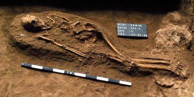
In Goa tigers, researchers discovered the tomb area and the findings of metal and pottery. Found 35 adults and children who are single or buried together. Also found in the cave wall paintings that became the first findings. During this time, Metro is considered to have shaped the prehistoric cave paintings.

According to Revelation, the findings in Goa Tiger is a trace of modern humans who lived 4,000 years Austronesian ago. After transferring the findings and make a mold of findings, the investigators still digging to find the oldest settlements in the life of Homo erectus.

Important species

Homo erectus occupied important positions in human evolution because it is a direct predecessor of Homo sapiens (modern humans) at this time.

According to Harry Widianto of Ancient Man Site Preservation Hall Sangiran, in the process line of evolution, Homo erectus is known to have rapid cultural development.

These humans are the creators and users of stone tools reliably. They develop specific technologies, such as hand-held axes.

Homo erectus also have a toughness in adapting to nature. They are the first species to leave their ancestral places in Africa 1.8 million years ago. They are able to adapt to climate change in the world, ranging from cold climate in Europe until hot climates along the equator.

Homo erectus migrated via land bridges formed by the shrinking of sea water. This eliminates shrinkage South China Sea and Java Sea to the ocean floor into the valley. The valley was the path of migration of Homo erectus to Indonesia. "They're not through the island of Sumatra and Kalimantan, because at that time the two islands is a plateau," said Harry.

In Indonesia, Homo erectus is found only in Java. This is because Java is a 'dead end' for humans to migrate eastward.

To the east, Homo erectus was blocked by a trough between Bali and Lombok, which reaches 8,000 meters and still the oceans. While still in the highlands of Sumatra, a difficult climb. Today, researchers continue to search for traces to find the oldest human settlements.